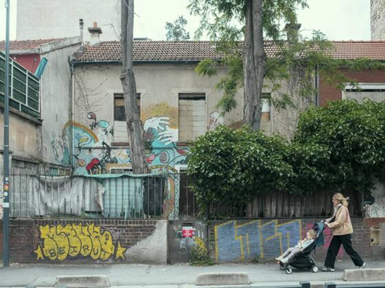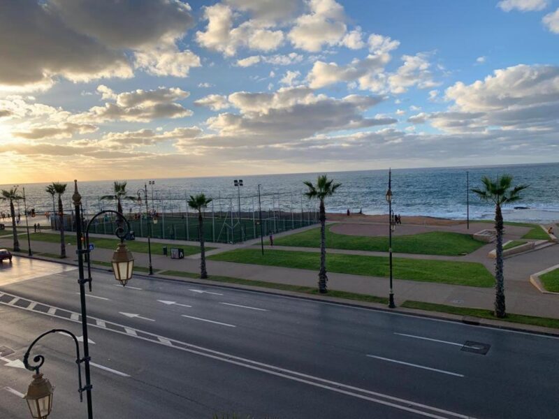
Imagine that you own a small piece of land overlooking the Atlantic Ocean. Your property measures 350 square metres, and you have lived there for decades. Next door, another family owns a plot of exactly the same size. Both properties are located in a neighbourhood where demand for land is increasing. Now imagine that a new urban development plan introduces a minimum plot size of 700 square metres for certain types of construction in your area.
Suddenly, neither property individually meets that requirement. Together, however, they do. Nothing has physically changed. The houses are still there, the street is the same, and the ocean continues to occupy the same horizon. But the planning rules have altered what can be developed on each property. This is a hypothetical example, not the reconstruction of two actual parcels, but it helps us understand one of the most interesting aspects of the urban transformation currently taking place in Rabat, Morocco’s capital.
In February 2025, the city published a new urban development plan containing a provision that attracted relatively little attention outside planning and real-estate circles: along the first coastal strip of L’Océan, certain construction opportunities would require a minimum land area of 700 square metres. At the same time, the plan encouraged projects with greater economic value, including new commercial and hospitality activities.
The rule may appear technical. But urban planning is not only about deciding where buildings can stand. It also influences how land can be used, what investors may be interested in buying, and which property owners can participate in future development. To understand why 700 square metres matter, we first need to examine the geography of Rabat’s Atlantic frontage.
A neighbourhood with a valuable location
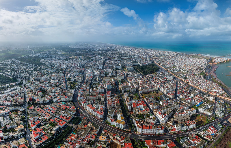
L’Océan is one of Rabat’s oldest neighbourhoods outside the historic medina. Its streets form part of the consolidated city, close to the Atlantic frontage and the capital’s main urban functions. Unlike an entirely new residential development, L’Océan contains buildings constructed during different historical periods, small shops, markets, apartments and properties that have been modified or subdivided over time. It is a neighbourhood with a history, an established population and an attractive location. And that last characteristic is particularly important.
Urban land derives much of its economic value from where it is located. Proximity to the city centre, access to infrastructure, views, public services and the possibility of developing profitable activities all influence what investors are prepared to pay. Along Rabat’s Atlantic frontage, the combination of coastal views and metropolitan centrality creates opportunities for residential, commercial and tourist development.
The authorities have been attempting to reorganise this waterfront for years. Projects involving public spaces, roads, heritage conservation and new tourist facilities form part of a longer process of urban modernisation. But the latest development plan introduces more specific rules governing what may happen in certain areas.
In January 2025, the Moroccan economic newspaper Médias24 published details of the proposed plan. Two months later, after its publication in the Bulletin officiel on 24 February, the newspaper examined the provisions affecting L’Océan. Among the proposed measures were the rehabilitation of historical buildings, improvements to roads and commercial spaces, the redevelopment of underused land and the promotion of projects with greater economic value along the coastline. And there was that figure again: 700 square metres…
What does the 700-square-metre rule actually mean?
An urban development plan, known in Morocco as a plan d’aménagement, establishes rules governing the use and development of land. It identifies roads, public facilities, building conditions, protected areas and the functions that may be permitted in different parts of the city.
One of its most important characteristics is that it does not necessarily treat every parcel in the same way. Some areas may allow residential construction, others commercial activities, and others may be reserved for public facilities or subject to heritage restrictions. In the case of L’Océan, the 2025 planning provisions described by Médias24 establish a minimum plot area of 700 square metres as a condition for development within the first strip of the Atlantic frontage. Projects with significant economic value are specifically encouraged.
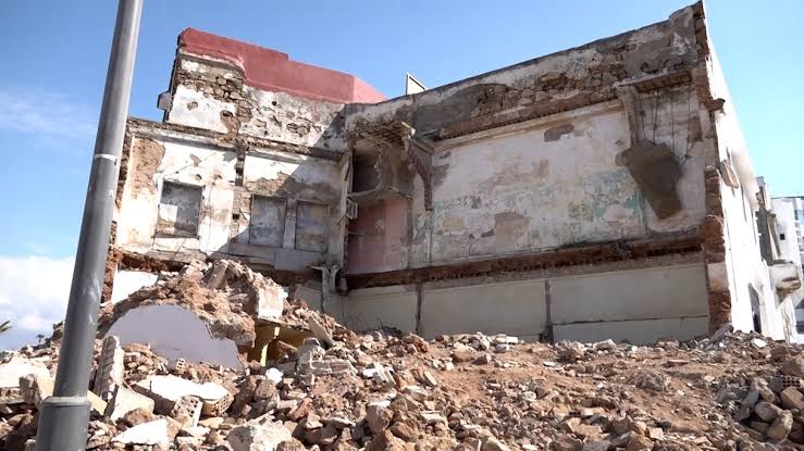
This does not mean that every property in L’Océan must measure at least 700 square metres. Nor does it mean that all existing buildings below that threshold are automatically illegal or must be demolished. The provision concerns specific development possibilities within a particular planning area. That distinction is essential.
Nevertheless, minimum plot sizes can have important economic consequences. If a particular form of development requires a larger parcel, a small property owner may be unable to undertake that project independently. There are different possible responses. Several neighbouring properties might be assembled into a single development site. A developer might purchase adjoining plots. Owners might enter into joint arrangements, or certain projects might simply become inaccessible to smaller landholders.
Planning a new Atlantic frontage
The 700-square-metre provision forms only one part of a broader programme described in the 2025 plan. The proposals for L’Océan address several different aspects of urban life. One concerns the coastal frontage, where higher-value economic activities are encouraged. Another involves the redevelopment of vacant or underused urban sites into facilities such as car parks, hotels, restaurants and commercial premises. The plan also envisages a large market and two neighbourhood markets, improvements to major streets, a more coherent organisation of commercial activities and architectural measures intended to improve the urban landscape.
Historical buildings receive particular attention. According to Médias24’s examination of the plan, four disused buildings identified as having significant heritage value were selected for rehabilitation, while other inhabited buildings with recognised architectural value were to be preserved. This is important because the plan cannot be described simply as a programme for constructing luxury buildings. It combines public facilities, conservation, commercial restructuring, infrastructure improvements and opportunities for private investment.
Some of these measures could improve everyday life in L’Océan. Better public spaces, rehabilitated heritage buildings and improved markets can benefit existing residents as well as visitors. The question, however, is how those improvements are distributed. For example, reorganising commercial activity may improve the appearance and functioning of a street. But it can also change the conditions under which small businesses operate. Rehabilitating an old building may preserve part of the neighbourhood’s architectural character while introducing a new use that serves a different population.
L’Océan is not the same as Corniche Nord
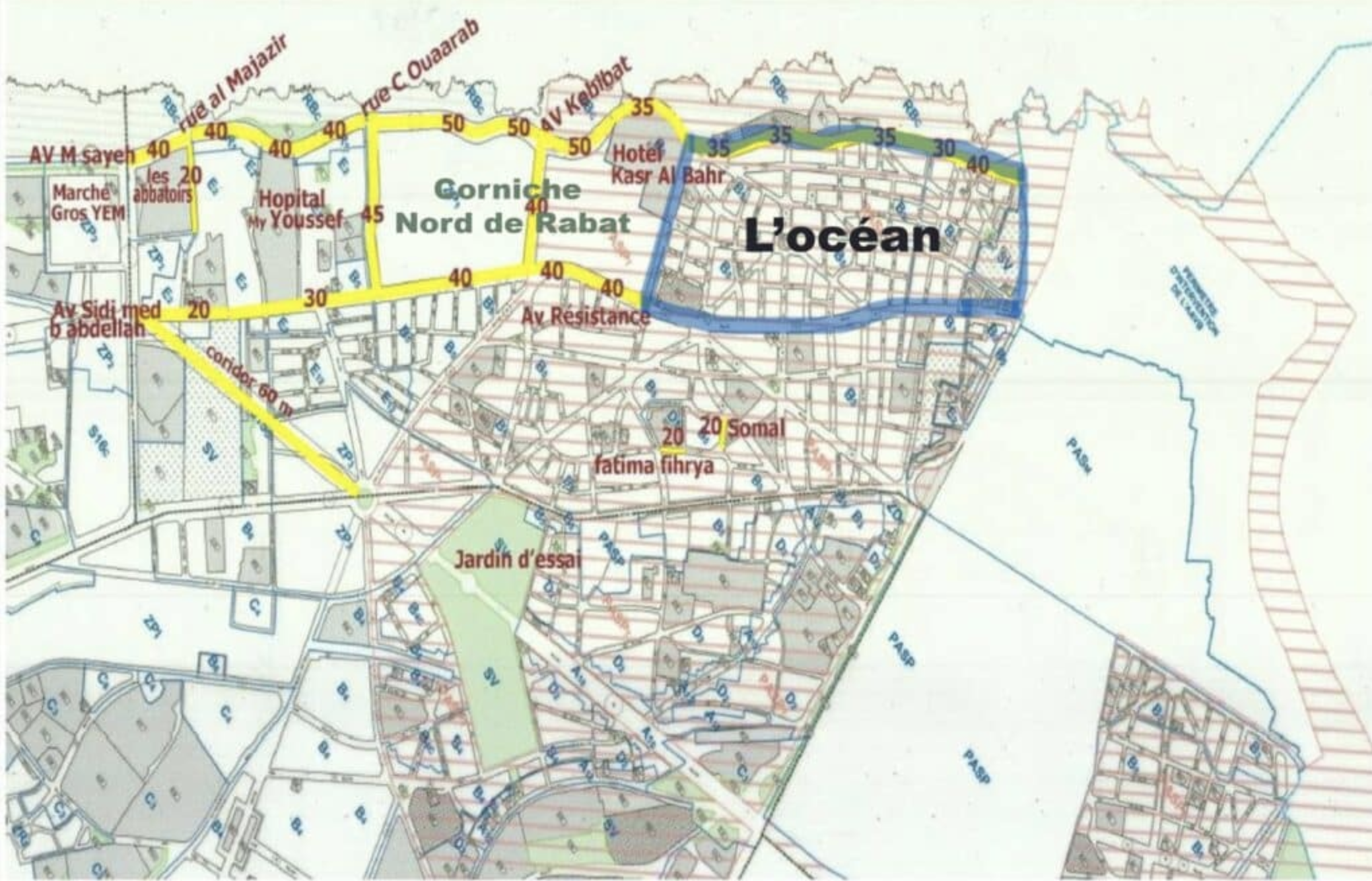
There is another geographical issue that makes this redevelopment particularly interesting. In discussions about Rabat’s Atlantic transformation, different places are sometimes grouped together under the general expression the corniche. But L’Océan, Sania Gharbia, Douar Askar and the Corniche Nord project are not interchangeable locations. In April 2026, Médias24 published an investigation that carefully distinguished the different planning areas.
Corniche Nord is a neighbouring project intended to introduce tourist, leisure and residential facilities along a section of the waterfront. Its proposed development area includes land previously occupied by military installations and Douar Askar. According to the investigation, however, that project’s perimeter stops at Avenue Brahim Roudani and does not extend into L’Océan proper.
Meanwhile, the requalification provisions affecting L’Océan are concentrated mainly on the first coastal strip and the redevelopment of existing underused sites. This geographical distinction matters because a project planned for one site cannot automatically explain every demolition occurring in a neighbouring area.
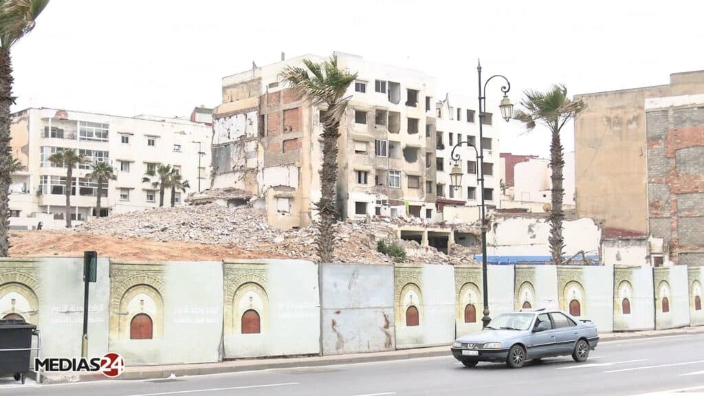
There is an additional complication: Médias24 observed that some demolitions in L’Océan had extended behind Avenue Mokhtar Gazouli, beyond the first coastal strip emphasised in the published requalification provisions. In other words, the geography of the demolitions appeared to be broader than the area whose future development was clearly described in the plan.
This does not necessarily prove that the works were unlawful or that they all formed part of a single undisclosed development project. Road improvements, property acquisitions, public-utility procedures and other interventions may involve different legal and spatial arrangements. But it does reveal an important gap between the areas where redevelopment was explicitly described and the places where buildings were being removed. For the residents and property owners affected, knowing exactly where one project ends and another begins is not an academic detail. It determines what can happen to their buildings, who is responsible for the intervention and which procedures apply.
There is also another layer of planning. L’Océan forms part of the buffer zone associated with Rabat’s UNESCO-listed heritage landscape. In October 2025, the Rabat-Salé Urban Agency announced preparations for a new planning and heritage-preservation document for that zone, intended to update the existing framework. The future of the neighbourhood is therefore being shaped by several planning considerations at once: economic development, infrastructure, coastal redevelopment and heritage preservation.
When a plan changes the value of land
By 2026, the transformation of L’Océan was no longer confined to planning documents. Buildings had been demolished, properties acquired and residents relocated. The operations combined negotiated sales, compensation arrangements and, subsequently, formal public-utility expropriation procedures. The legal sequence was more complex than the 700-square-metre rule alone.
In fact, a ministerial decision published in Morocco’s Official Bulletin No. 7488 on 5 March 2026 referred to land required for the development of Rabat’s urban area and the February 2024 agreement between the Direction des Domaines de l’État and the Wilaya of Rabat-Salé-Kénitra concerning property acquisitions in L’Océan.
This official record demonstrates an institutional programme of land acquisition. It does not establish the final commercial use of every property affected. And that distinction brings us back to the economic role of planning.
A neighbourhood does not have to be completely rebuilt for expectations about its future value to change. Once new uses are encouraged, larger development sites become relevant and authorities demonstrate an intention to reorganise the area, investors can begin evaluating opportunities that did not previously exist in the same form. But anticipated value is not the same as realised profit.
We cannot assume that every property has increased in market value by a particular amount, or that the price eventually paid to its former owner reflects the profits that might be generated by future construction… nor can we conclude that every demolished building will be replaced by a hotel or a luxury apartment. The available documentation supports a more precise interpretation: the planning framework is creating new possibilities for higher-value development, while the ultimate destination of many cleared parcels remains uncertain.
In April 2026, residents interviewed by Médias24 described unclear demolition boundaries, concerns about compensation and difficulties anticipating what would happen to their properties. Some suggested that the sums offered would not allow them to obtain equivalent housing in central Rabat. Others considered the compensation reasonable or saw redevelopment as an opportunity to improve the neighbourhood.
The Atlantic coast and the city of 2030
Rabat’s redevelopment also belongs to a wider political context. Morocco will co-host the 2030 FIFA World Cup with Spain and Portugal, while the country has been investing in infrastructure, tourism and international visibility. Municipal authorities have presented the new development plan as part of the modernisation of the capital and its preparation for a more prominent international role.
This provides an important context for understanding the urgency surrounding infrastructure and urban renewal. But context is not the same as direct causation. The development of Rabat’s waterfront began long before the announcement of the 2030 World Cup. Planning projects, heritage initiatives and major investments have transformed the capital for more than two decades.
It would therefore be misleading to attribute every demolition in L’Océan to the tournament. The more interesting question is whether the approaching international event has helped accelerate an existing urban transformation, increasing the importance attached to investment, mobility, tourism and the appearance of the Atlantic frontage. And here the relationship between planning and economic value becomes especially visible.
A city preparing for international visitors may wish to improve its public spaces, rehabilitate historic buildings and expand its accommodation capacity. These can be legitimate objectives. But improving the attractiveness of a neighbourhood also creates a distributional question: who benefits from the new value generated by public planning and private investment? If existing residents and small businesses can remain and participate in the changes, urban redevelopment may bring improvements without requiring their replacement.
If the new opportunities are accessible mainly to actors able to acquire larger plots and finance more expensive projects, the transformation may progressively change the social and economic composition of the neighbourhood. The planning documents alone do not establish which outcome will ultimately prevail in L’Océan. What they do show is that the rules governing its future are already changing.
A number that tells us more than it seems
Let us return to the hypothetical example with which we began: two neighbouring properties, each measuring 350 square metres, stand beside the Atlantic Ocean. Together they reach 700 square metres, the minimum area required for certain construction opportunities under the coastal planning provision.
The number does not tell us what the properties are worth. It does not prove that their owners must sell, or that their homes will be demolished. But it helps explain something fundamental about urban planning.
A regulation can transform the economic possibilities of a place without moving that place a single metre. It can encourage some forms of development, restrict others and change the relative position of different owners and investors. Combined with acquisition policies, infrastructure projects and redevelopment expectations, those rules can become part of a much wider transformation of urban land.
In Rabat, the Atlantic coastline has not changed its geographical position. It remains the same remarkable meeting point between the city and the ocean. What is changing is the way the city intends to use that location. And that is why a rule expressed in square metres deserves our attention. Behind the technical language of urban planning lies a much larger question: who will have the resources, rights and opportunities to participate in the future of L’Océan?