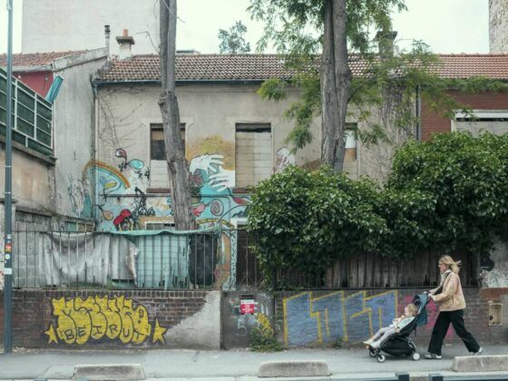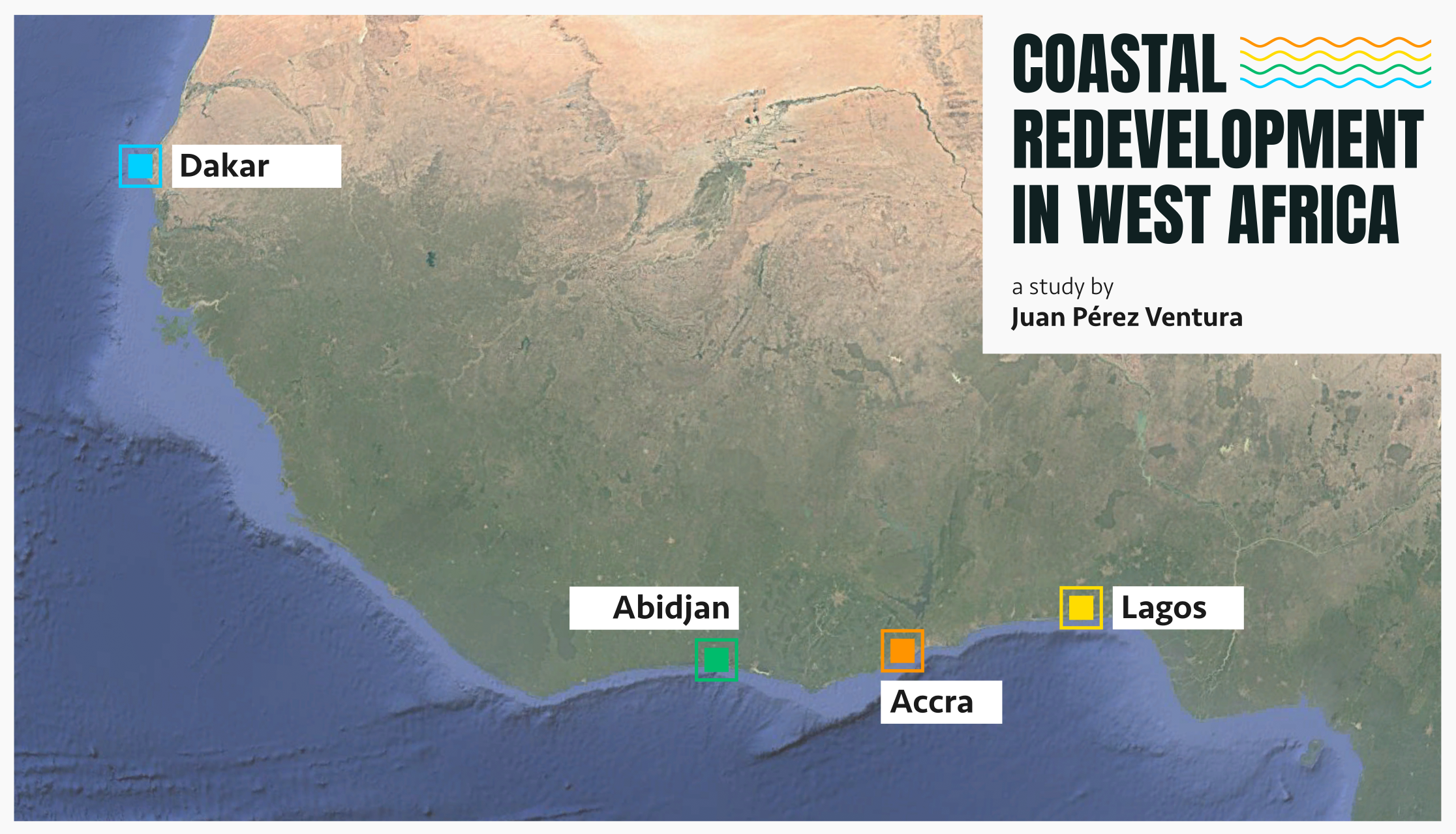
A fishing harbour in Accra, a district built on reclaimed land in Lagos, a seafront promenade in Dakar and a lagoon rehabilitation project in Abidjan. Each offers a different kind of improvement. Each also changes what people who already depend on the shore can do there.
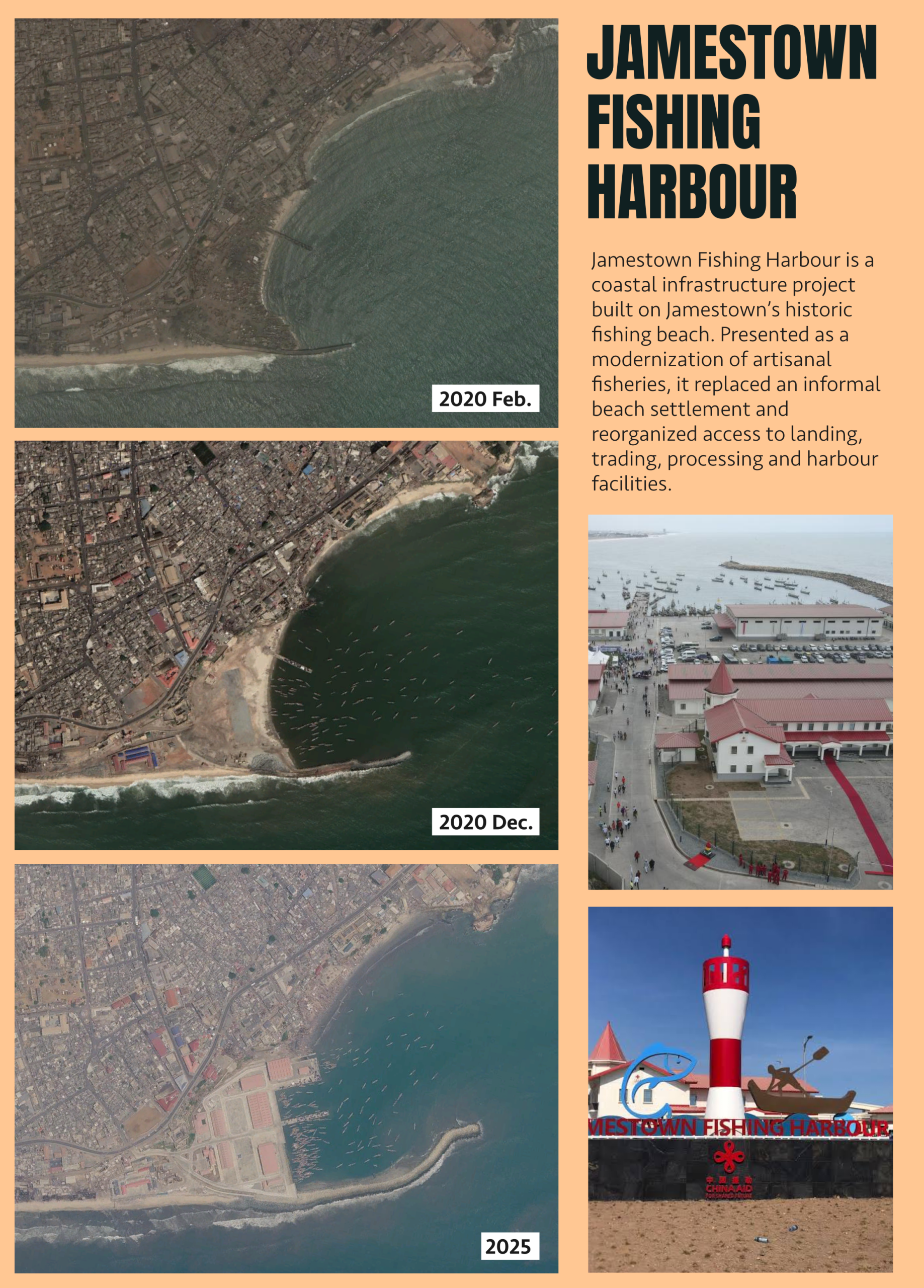
In an aerial image of Accra from February 2020, small buildings occupy a strip of beach below the old neighbourhood of Jamestown. By December, the same strip looks markedly different: the settlement has been demolished. In an image from 2025, there is a harbour basin, with buildings beside it serving the fishing trade. The three views, taken from Google Earth’s historical imagery, show how a beach became a port. The port is far easier to make out from above than most of the work that took place on the beach before it.
In September 2026, two years after the harbour opened, a group of journalists went down to the landing area. Some fish traders were still selling outside the new market, close to where the catch came ashore. One explained that concerns about drainage had put some traders off working inside. The harbour management defended the drainage system, and a trader who used the market spoke favourably about the facilities. Linda Incoom’s report captures a disagreement the aerial images cannot show. On a plan, the landing area and the market appear as parts of the same facility. For traders, how fish gets from one to the other is part of the working day.
The same change of scale helps make sense of three other cities on the West African coast. In Lagos, the land behind a seawall looks different when the question is what can be sold and who can buy it. In Dakar, a continuous strip of coastline on a map turns into a series of routes, entrances and barriers at street level. In Abidjan, the ground beside a polluted lagoon was also the ground on which people grew plants for a living. There is no single explanation for all four places. What makes them worth comparing is the gap between what a project sets out to improve and what it takes to keep using the shore once that project is under way.
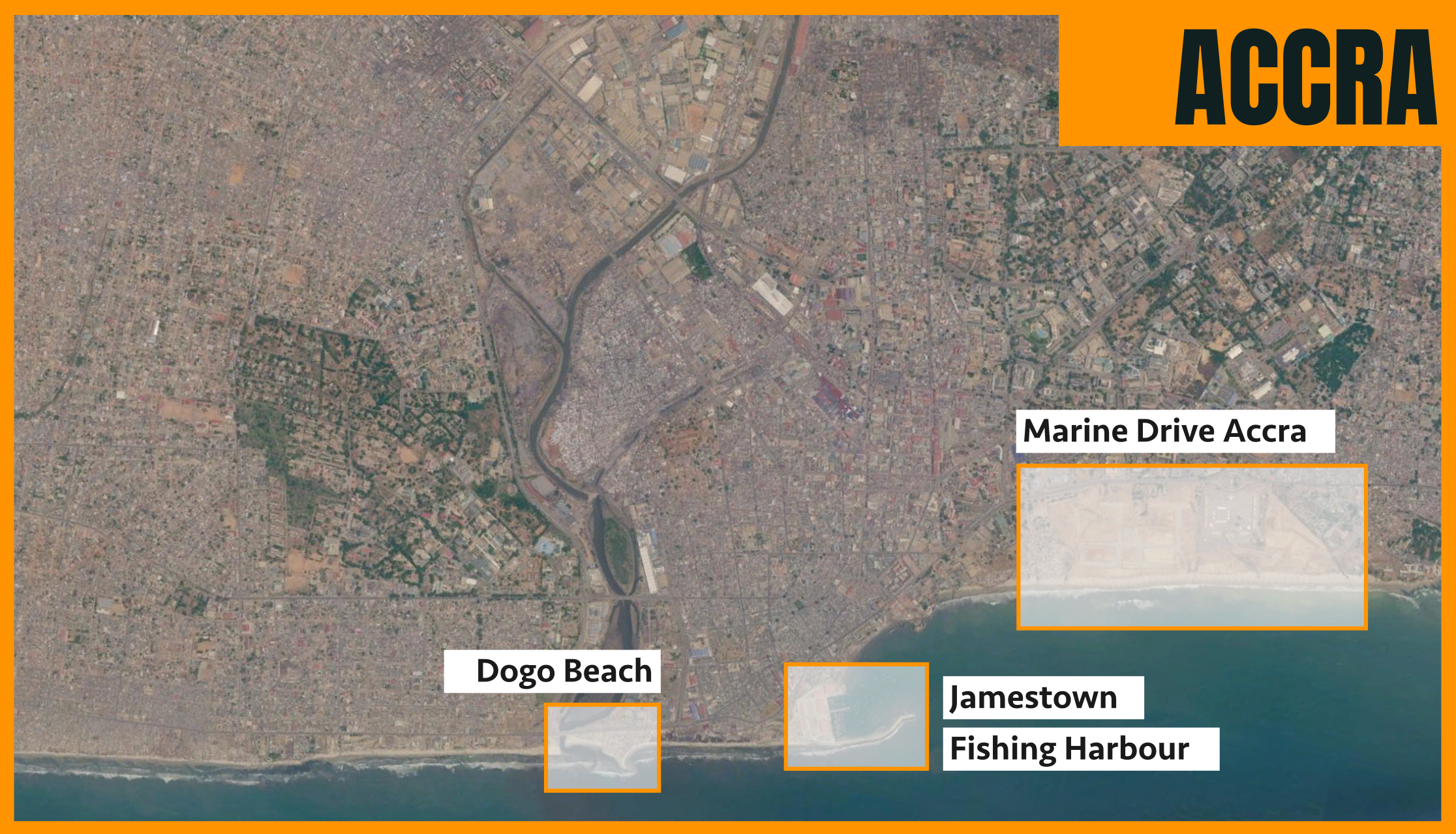
Accra: what happened to the beach?
Before the harbour, Jamestown Beach was already a place of work. Canoes came ashore there. Fish was sold and processed nearby, fishing equipment was repaired, and people lived among the places where those activities took place. A home on the beach provided more than shelter. It kept residents close to the catch, to work and to neighbours who could lend a hand. A plan could mark the whole strip as the site of a new harbour. The people who used it had several reasons to be there, and only some of them had a place in the new design.
The beach was not cleared all at once. Geographers Bianca Malkoc and Leigh Johnson documented at least four cycles of demolition. After a clearance, some residents rebuilt with salvaged materials, making smaller structures that could be taken apart and put back up. This made it possible to stay close to the beach, but at the cost of more precarious housing. The final major demolition in mid-2020 affected approximately 450 people still living there. Some residents had hoped that the harbour would bring better facilities for the fishing trade. That did not make the loss of their homes incidental. A person could want both a better place to land fish and somewhere to live near it.
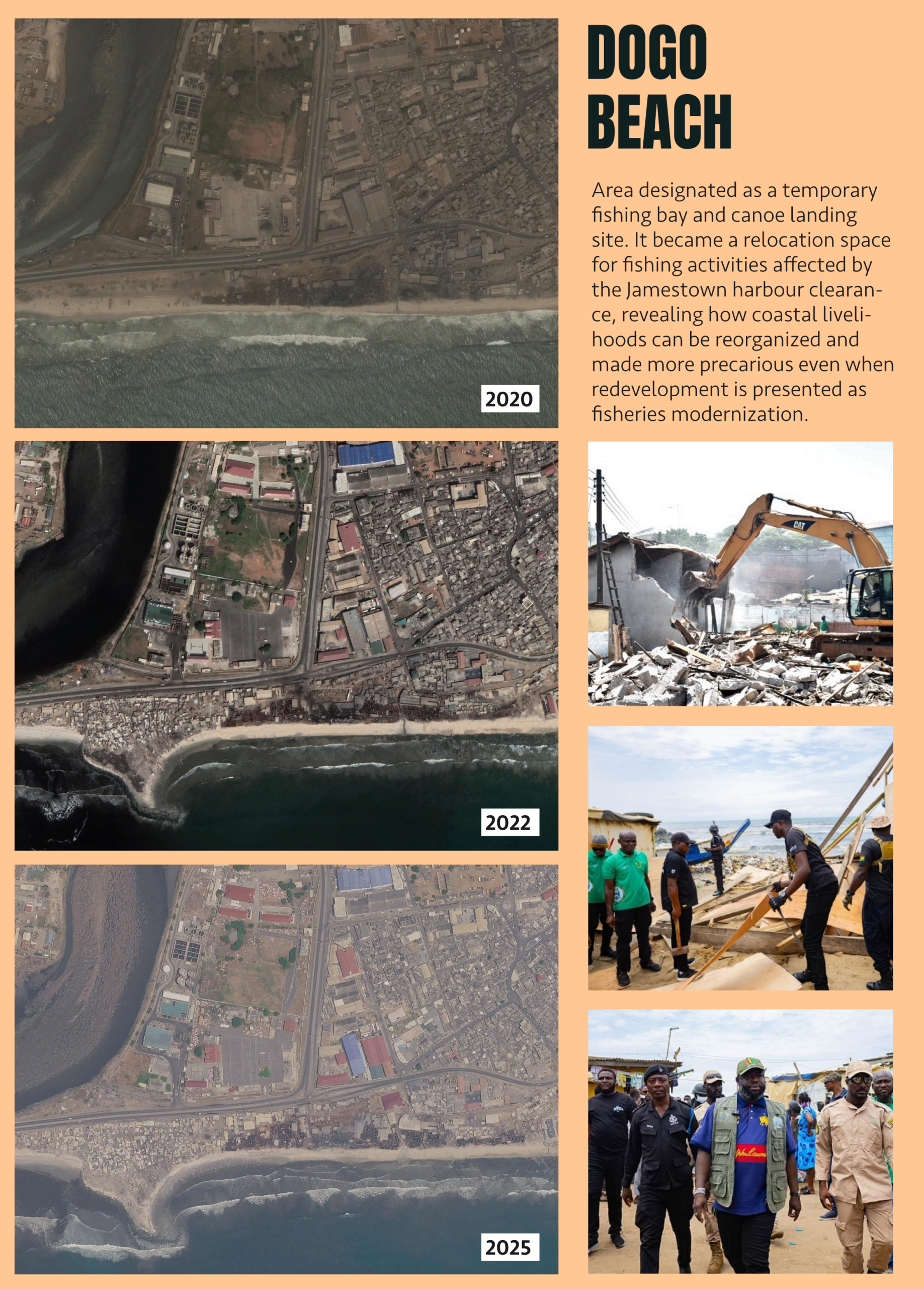
The story continues a short distance away at Dogo Beach, near the outlet of the Korle Lagoon. The city provided a temporary canoe landing there. Fish processing and housing reappeared alongside it, and demolitions followed in 2021. In September 2026, the Accra Metropolitan Assembly issued another notice to vacate the site. The notice does not establish that another demolition took place. It does show how long the uncertainty lasted. A temporary landing site can solve an immediate problem for a canoe crew without giving anyone who works or lives nearby much assurance about the following year.
The Chinese-funded harbour opened in September 2024. It offered facilities for landing, selling, processing and storing fish that the old beach could not provide in the same form. Those improvements mattered, but they came with practical problems. Incoom reported that shallow water limited access for larger vessels. In October 2026, the chief fisherman said fishers could not use the cold store. Harbour management disputed that account and said that arrangements for paying for electricity still had to be agreed. The competing accounts do not settle whether the equipment was working. They do show why listing a cold store among a port’s facilities says little about whether a fisher can actually leave a catch there overnight.
The research describes this as conditional infrastructural inclusion. The harbour gives an established activity a place in the new development, but changes the terms on which that activity can take place. A fishing boat needs sufficient depth to enter. A trader needs a stall that works for the way the catch is bought and sold. Cold storage depends on arrangements that go beyond the construction of the building itself. The harbour has no equivalent for the housing that once stood on the beach. Besides, evidence that some traders are now working inside the market does not establish how many of the people displaced in 2020 were able to return. There is a difference between making provision for fishing and making provision for everyone whose livelihood depended on the old beach.
That distinction changes how the project is evaluated. A harbour can be an improvement for someone who lands fish there and still leave a former resident worse off. Even people who never lived on the beach may experience the harbour differently: a boat crew, a fish processor and a market trader do not need the same thing from it. An assessment that treats them all as beneficiaries of better fishing infrastructure would miss why the distance from the landing area to a stall, or the cost of using a cold store, matters. Those are no longer questions about whether the port was delivered. They are questions about how it operates.
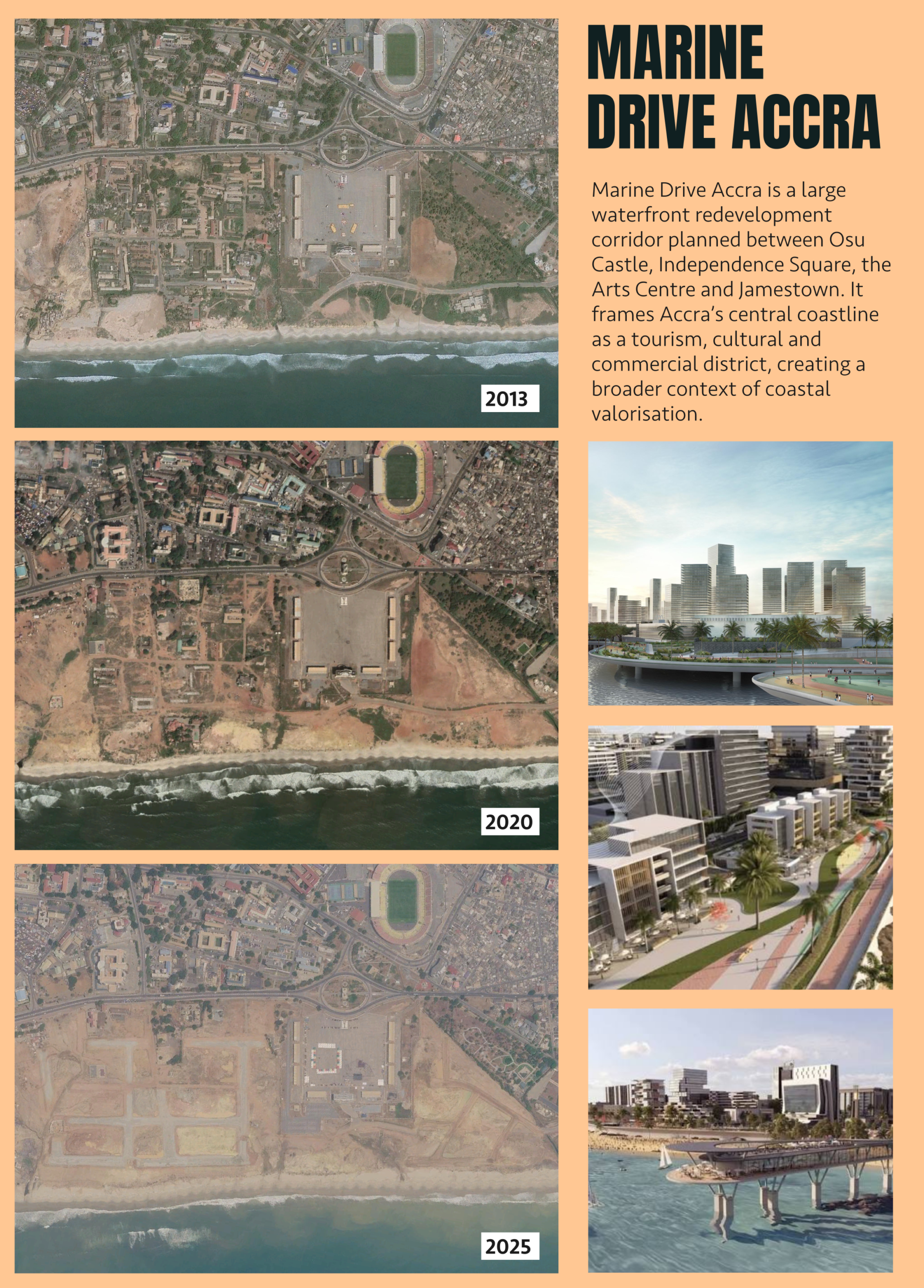
A separate proposal helps clarify what kind of project Jamestown was. Marine Drive, also on Accra’s central waterfront, grew out of decades of plans for the city’s seafront. The version launched in 2017 envisaged hotels, cultural venues, shops and a public promenade. As of May 2026 it was still under review. A plan of this kind can change expectations about what central coastal land is for well before any hotel opens. That makes it part of the context for understanding Accra, not the cause of the Jamestown demolitions. The fishing harbour changed an existing fishing beach into a regulated facility for the same industry. Marine Drive proposed a different future for the wider seafront.
Lagos: the land that used to be sea
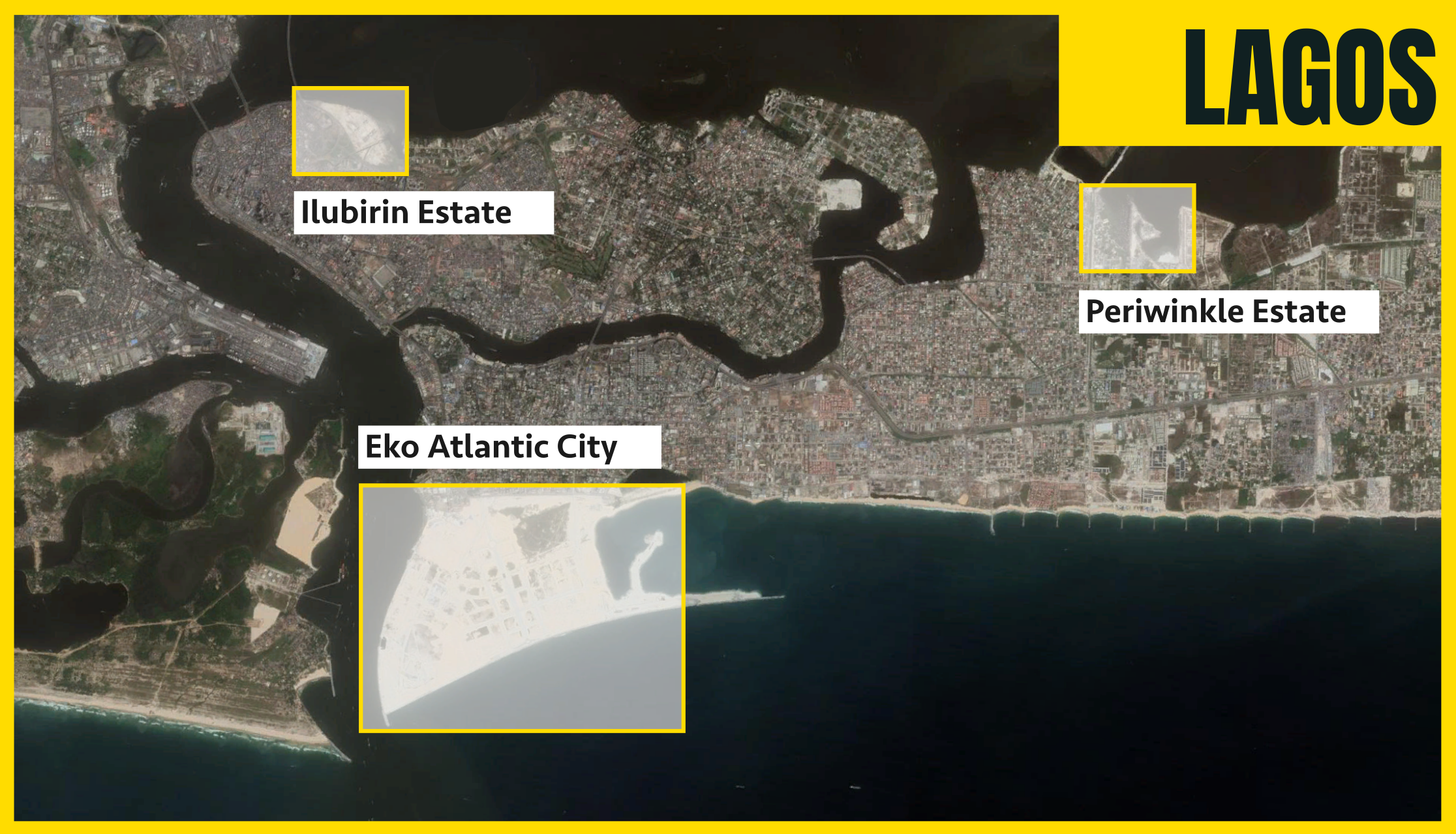
A map of Lagos shows why the city’s waterfront projects should not all be treated as one. On the Atlantic side of Victoria Island, Eko Atlantic extends into the ocean. On the lagoon shore lie the sites of Otodo-Gbame and Ilubirin. Water is central to the value of all three locations, but the projects differ in a fundamental respect. One set out to create land where there had been water. The other two involved places where people already lived and worked.
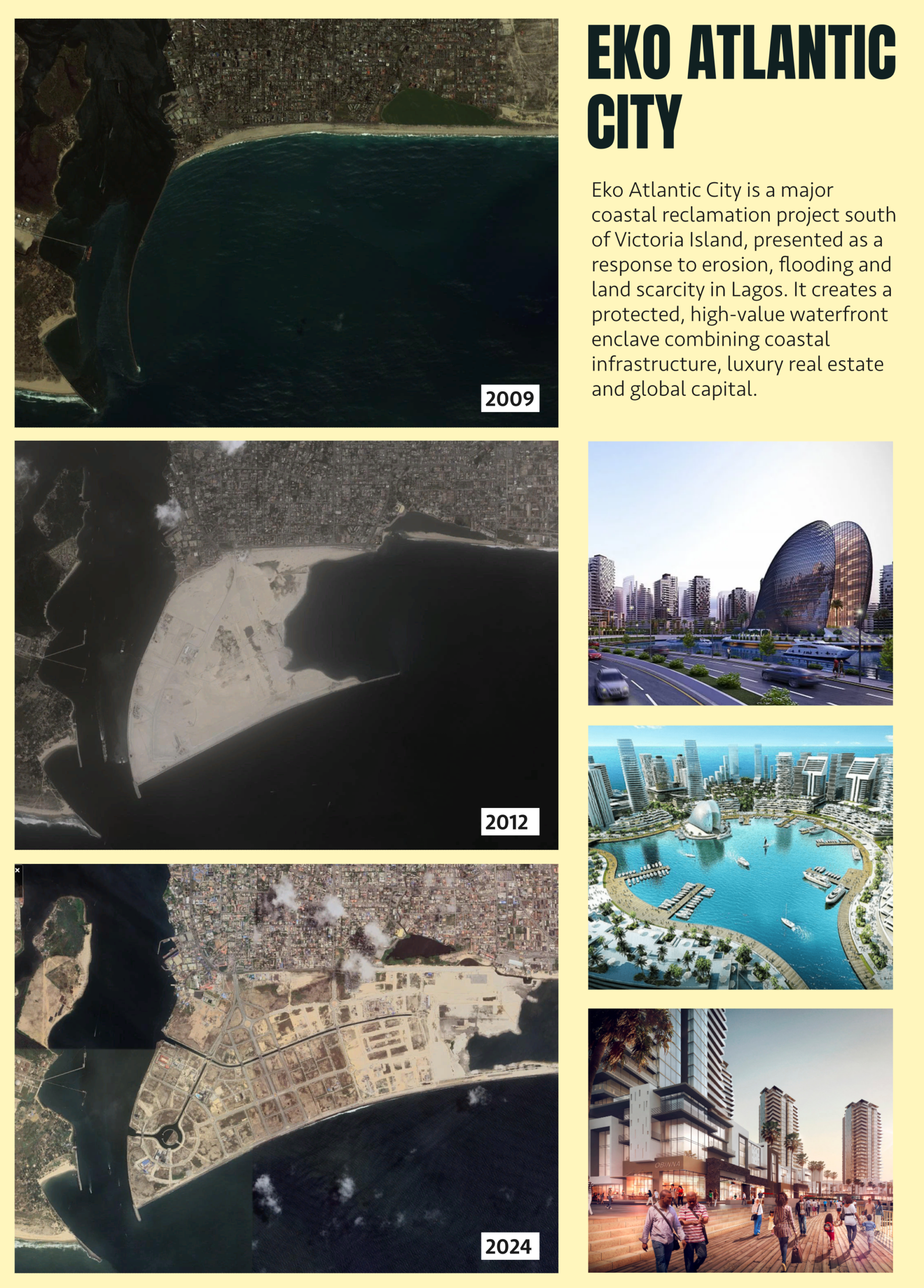
At Eko Atlantic, the most revealing feature in an aerial image is the ground beneath the towers. In the historical views of the site, from 2009, 2012 and 2024, a platform emerges from the water and a street grid takes shape on it. According to the developer’s timeline, more than five million square metres had been reclaimed by 2013. That is more than five square kilometres where no such building plots had existed. A seawall protects this land from Atlantic waves, responding to real problems with erosion and storms around the former Bar Beach. It also makes it possible to develop valuable property on the protected ground. Those two functions belong to the same project: the defence helps make the land usable, and the new land can be sold for urban development.
Geographer Idowu Ajibade asks what happens when that protection is assessed across Lagos rather than just within the new district. The question is not whether a seawall can protect the plot immediately behind it. The question is who receives that protection, how it is tied to development and what lies outside the area served by the investment. An engineering project can be effective within its boundary without distributing its benefits evenly across the city.
The making of new land is also different from the redevelopment of an inhabited site. At Eko Atlantic, the construction photographs help explain how a new district becomes possible. They do not, by themselves, tell a story of direct eviction. That story has to be traced separately on the lagoon shore. Putting the two shores next to each other reveals how coastal investment can work through different means within a single city: by producing protected ground for development in one place, and by changing who can remain on land that already exists in another.
At Otodo-Gbame, the shoreline was already a place to live and earn a living. Amnesty International documented forced evictions carried out between November 2016 and April 2017. In June 2017 the Lagos State High Court ruled in favour of affected waterfront communities and ordered resettlement. By then, homes had been destroyed and the loss extended to work tied to the lagoon. Moving a household away from the water can mean moving it away from a place to land a boat, buy fish or sell goods. A new roof, if available, does not in itself restore those connections.
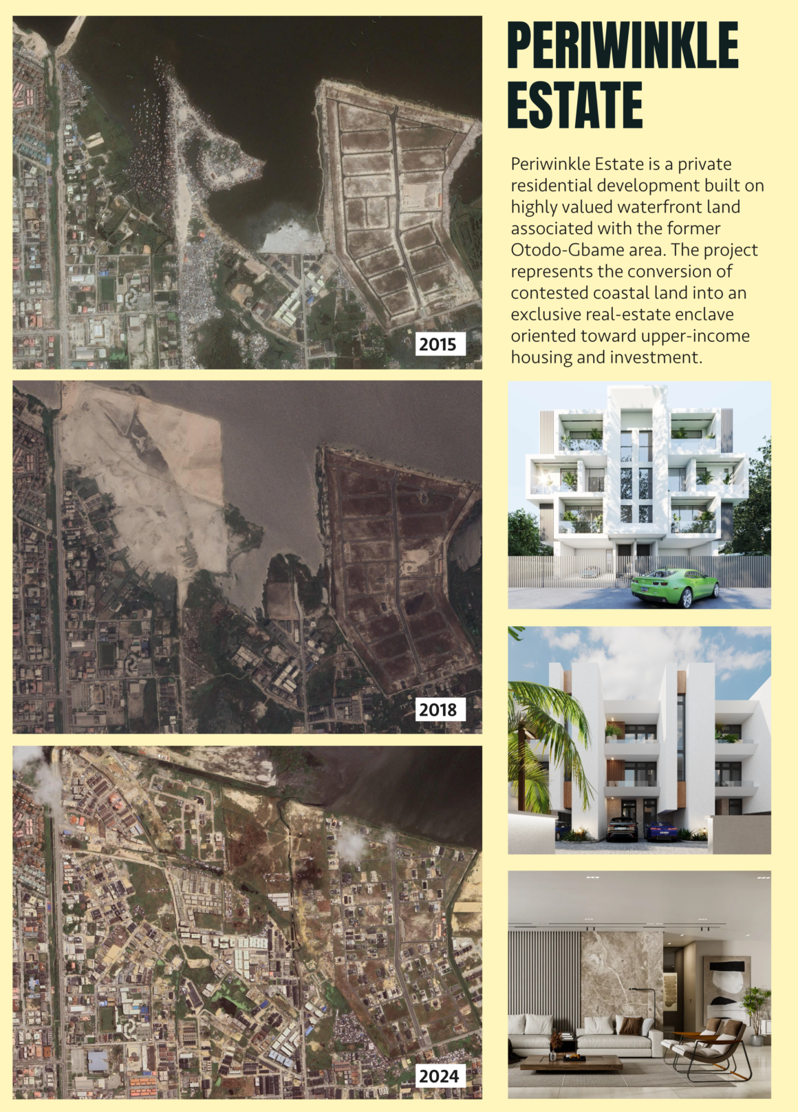
Amnesty compared images of the former settlement with promotional imagery for Periwinkle Estate and identified an overlap. Part of the land being marketed for an upscale development coincided with the area from which the community had been expelled. The comparison is useful because it places displacement and redevelopment on some of the same ground. It does not explain every decision about land ownership or establish the role of each party in the evictions. And it should not be confused with Eko Atlantic, a different development on the Atlantic shoreline.
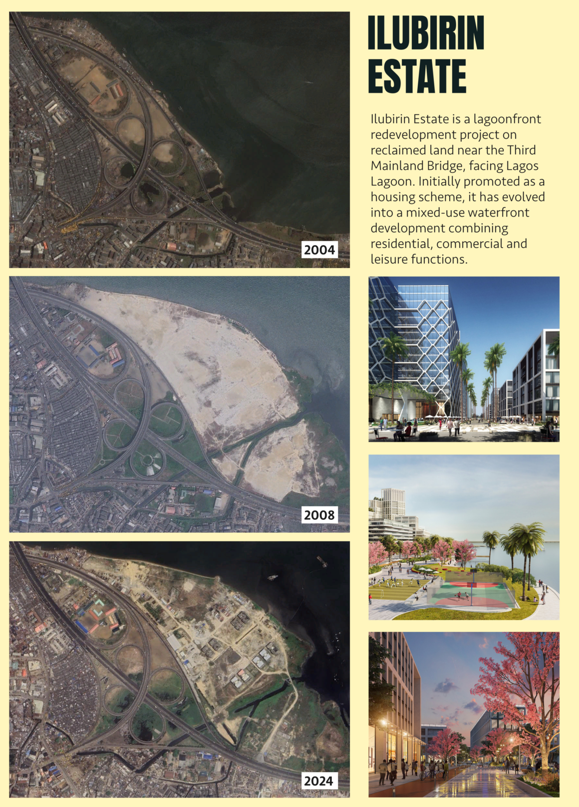
At Ilubirin, near the Third Mainland Bridge, the word to pay attention to is housing. In 2015, the Nigerian press reported on a proposed housing development covering about fifteen hectares. Amnesty documented evictions there between 2016 and 2017, affecting a lagoon-side community whose livelihoods included fishing. The developer markets Ilubirin as a new neighbourhood beside the lagoon. There is no contradiction in saying that a project builds housing and displaces people who already had housing on the site. The two statements concern different people. Counting new homes answers a question about construction; it does not establish whether the people who lost their homes can afford, obtain or return to any of the new ones.
Dakar: finding a way down to the sea
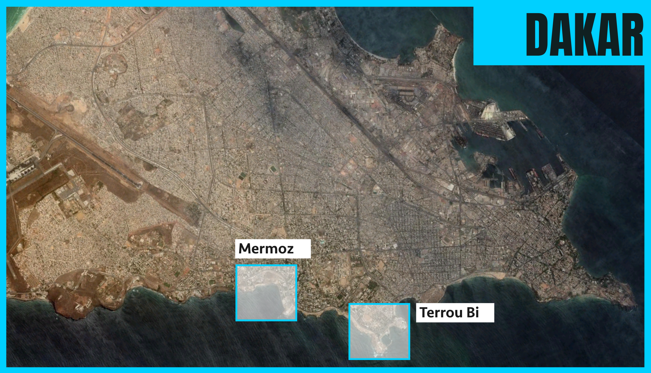
From above, Dakar’s Corniche Ouest appears as a stretch of city running alongside the Atlantic. At street level, proximity is only part of the story. Someone can walk along the seafront, see the water and still have to look for a way down. The question in this case is less about who lives directly on the coast than about who can reach it, where and on what terms.
A 1985 Senegalese law includes the shore and a strip of one hundred metres measured from the highest tide line in the natural public domain. The designation matters, but it answers a different question from the one facing a person who wants to reach the sea. A legal description does not locate a staircase, explain what happens at a gate or establish how any particular enclosure was authorised.
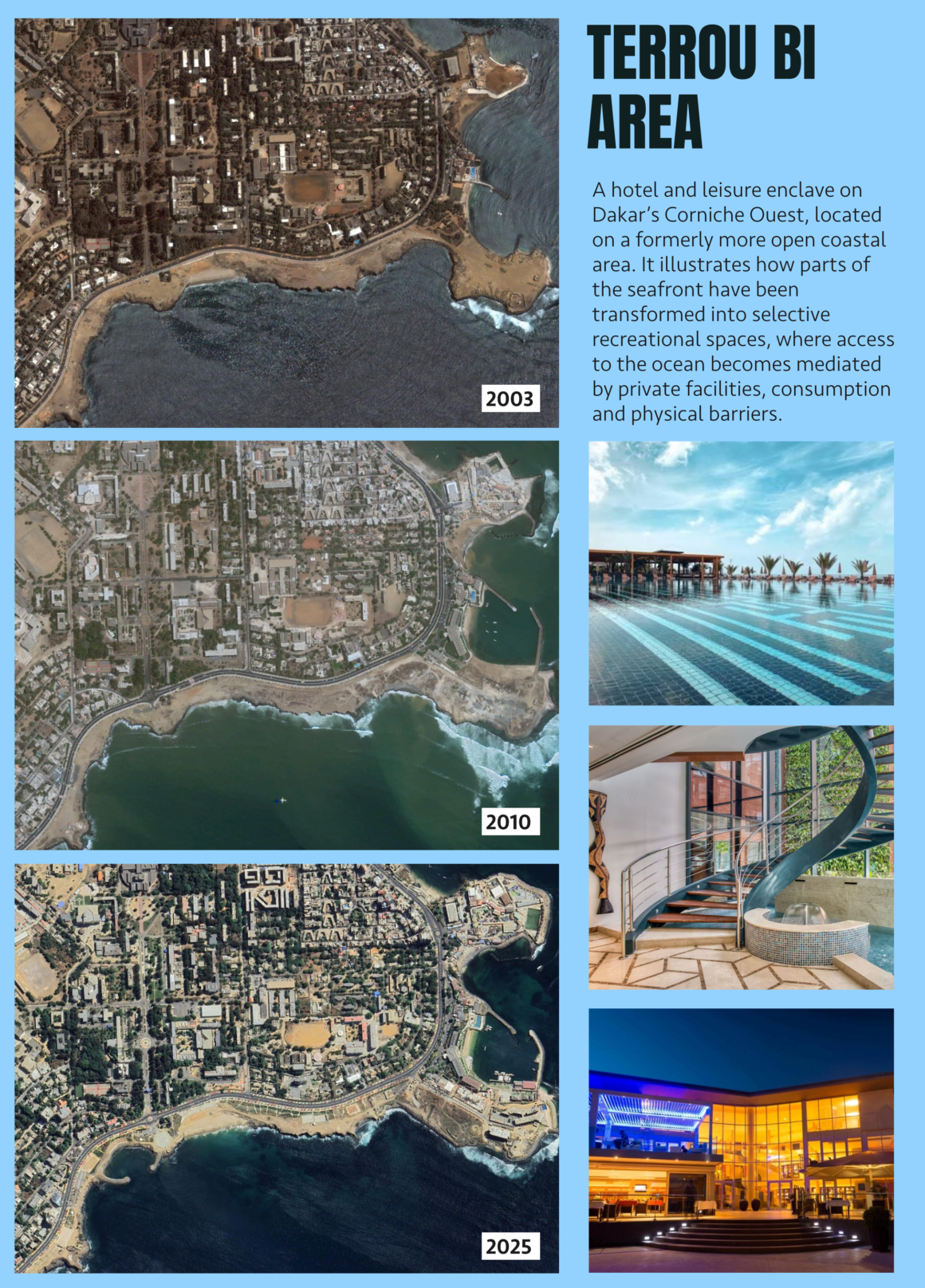
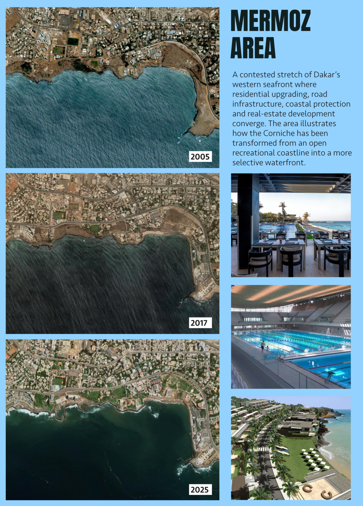
Two places bring that difference into focus. In Mermoz, photographs of a fenced coastal plot prompted allegations of privatisation. The photographs show a fence. They do not establish the legal status of the land or reconstruct the routes previously taken by residents. At Terrou-Bi, the conditions are stated by the hotel itself: visitors not staying at the hotel can use its beach and pool facilities for a fee. That is a documented condition of entry to a particular place, not evidence that the hotel’s arrangements apply to the entire seafront.
The public authorities have also pursued improvements intended to make the coast more accessible. A 2021 decree declared the Corniche Ouest redevelopment to be of public utility. The scheme included promenades, sports spaces, coastal protection works and improvements to the fishing market at Soumbédioune. Disputes over coastal enclosures predated the scheme. A public promenade and a paid entrance can both exist along the same shore, without the former causing the latter or cancelling its effect. To establish a loss of access would require knowing who used a particular stretch before, where they entered and what has changed since. The evidence from Dakar is strongest when it remains at that scale.
Abidjan: what a plant nursery needs
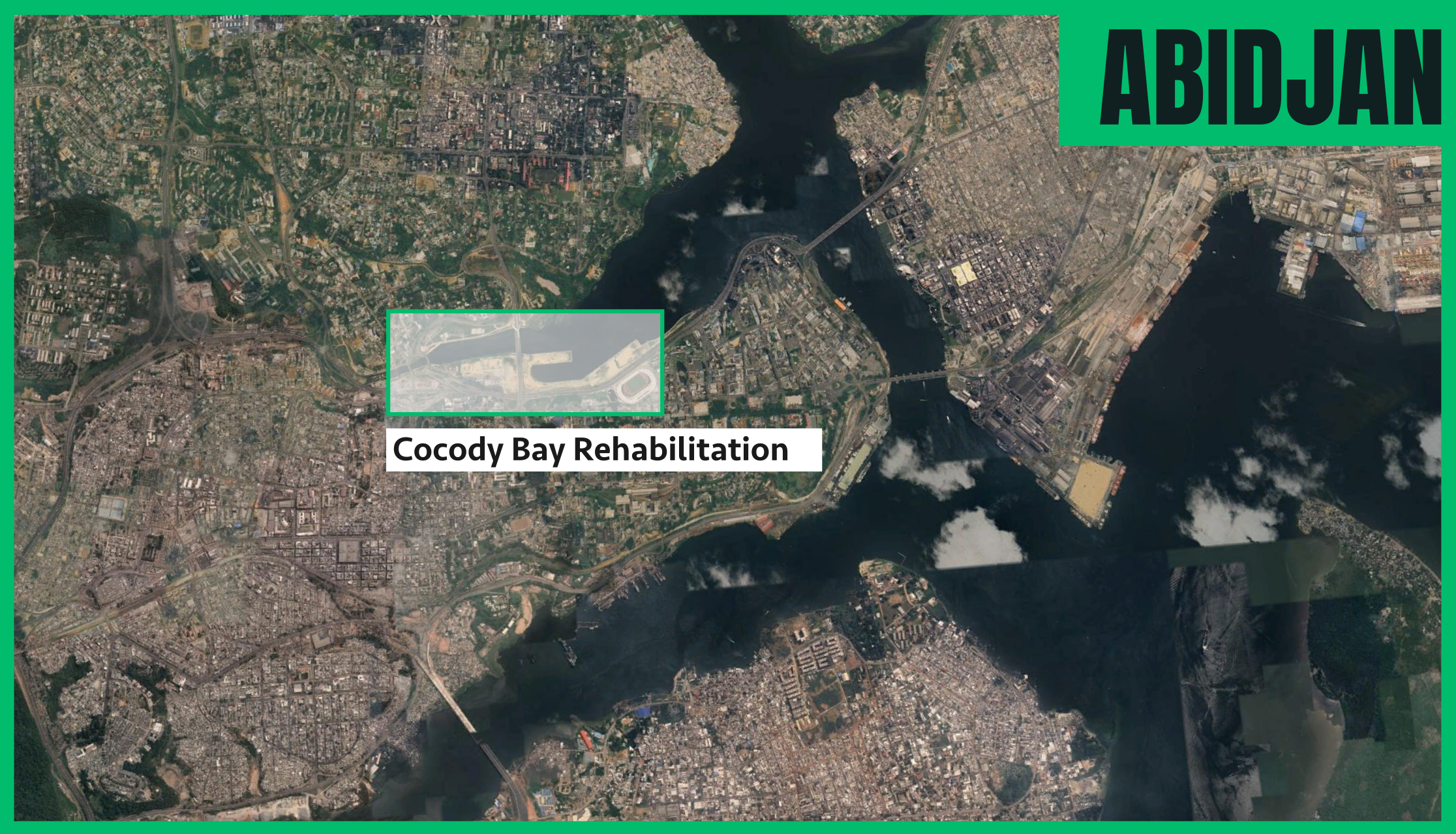
At Cocody Bay, part of Abidjan’s Ébrié Lagoon, access to water mattered for a trade that can be easy to miss on a map. People grew ornamental plants along the shore. A 2012 impact assessment, discussed in Sharon Teixeira’s study, identified 46 people growing and selling plants in the study area. That figure describes the scale of an existing activity. It is not a count of people evicted.
One grower interviewed by Teixeira dated his removal from the bay to 2013. He was able to resume his trade elsewhere, with less space and higher costs. The old site offered a combination that was difficult to replace: water nearby and customers within reach. Keeping the same occupation after a move, in other words, does not mean being able to earn a living from it on the same terms. For a nursery, the suitability of the plot matters as much as the square metres available.
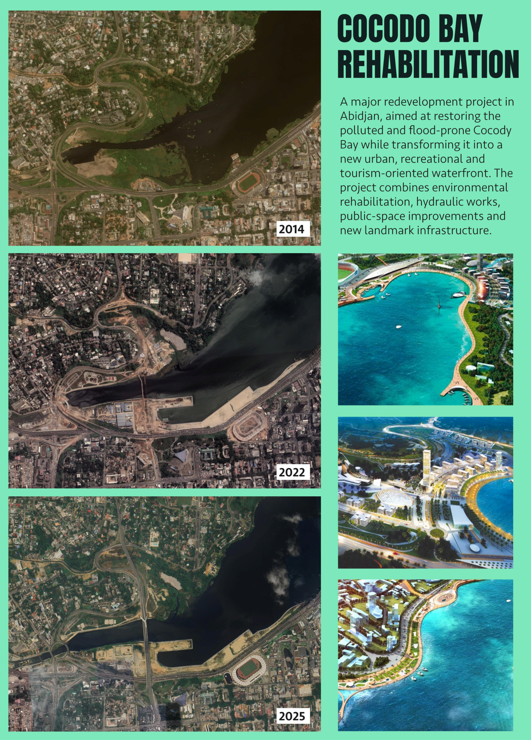
There were good reasons to improve the bay. Pollution, sedimentation and flooding were already on the government’s agenda in 2013. Agreements between Côte d’Ivoire and Morocco in 2015 gave the intervention a wider scope, combining drainage and dredging with plans for promenades, leisure facilities and a marina. In 2023, the Alassane Ouattara Bridge was inaugurated, linking Cocody and Plateau. The bridge offers a new connection across the city. The story of the grower concerns a different connection: the one between a particular plot, a water supply and the people who bought his plants.
Those accounts unfold on different timetables. The grower left before the 2015 agreements and a decade before the bridge opened. His removal cannot simply be attributed to the later works. It belongs to a longer transformation of the lagoon edge, in which some working uses lost their place before the redevelopment assumed its most visible form. A study that only counted demolished homes would have little to say about what happened to his business. Yet that loss is part of what changed around the bay.
Beyond the opening ceremony
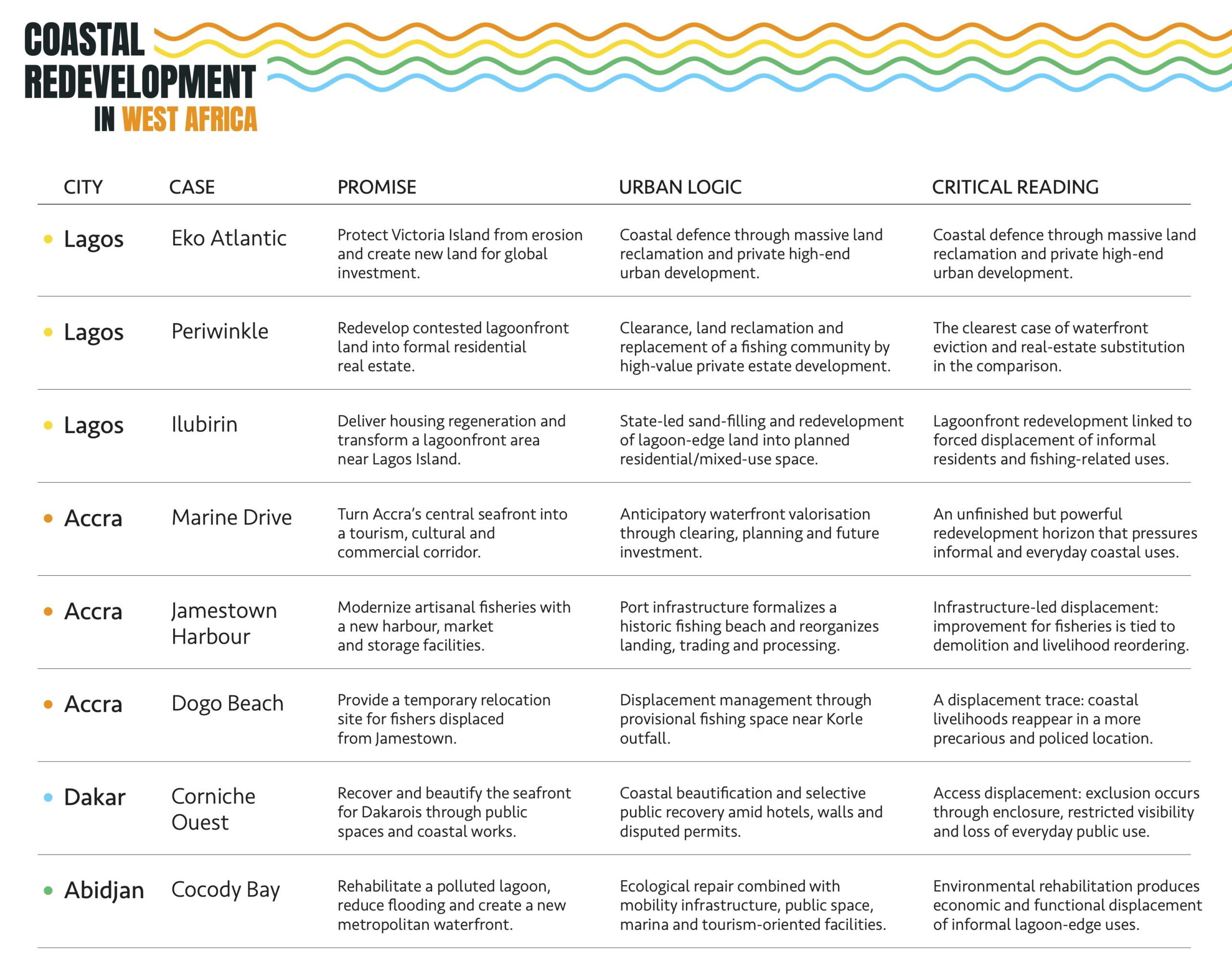
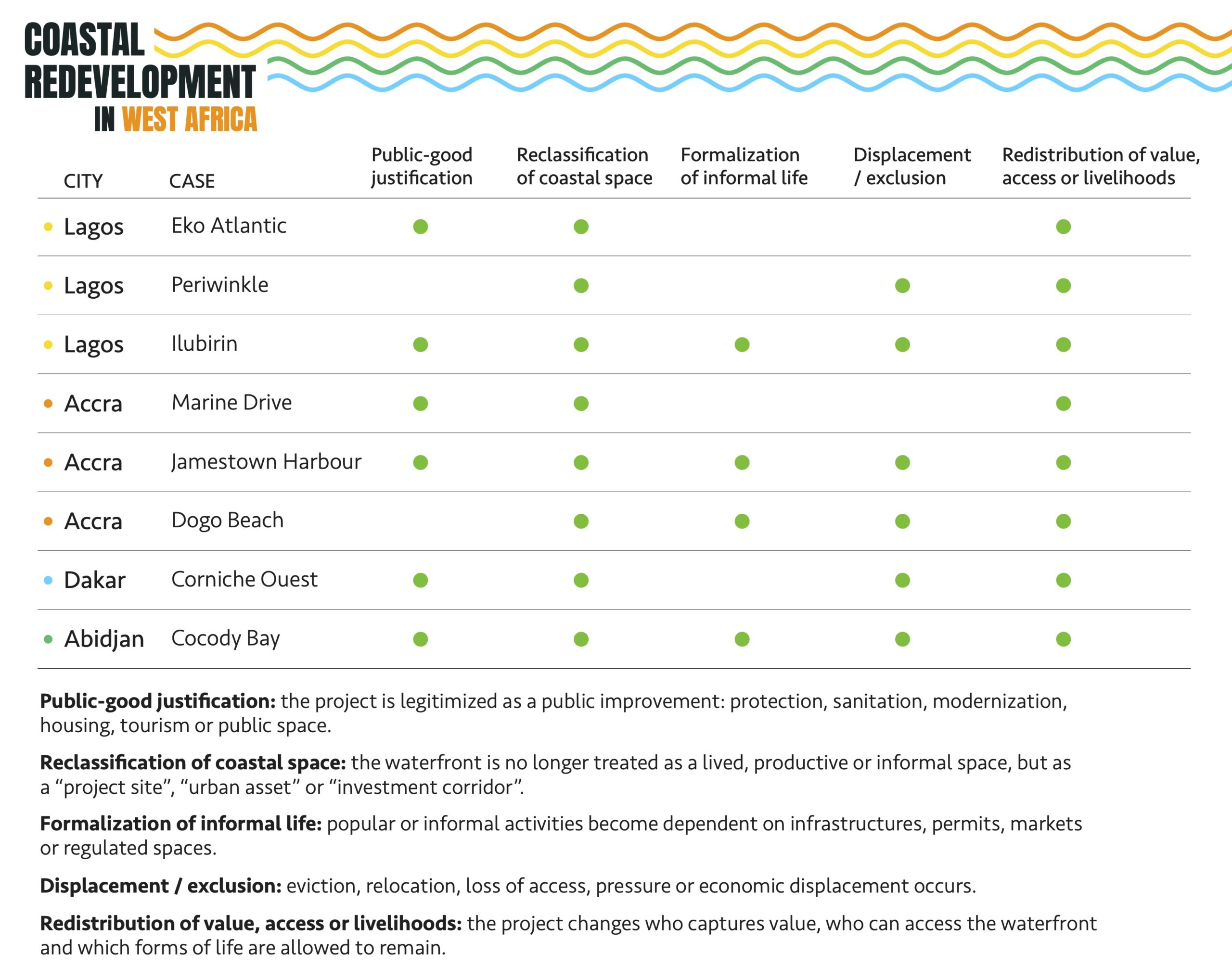
The term blue gentrification is useful when investment raises the value of a waterfront and makes it harder for existing users to stay. That lens brings something important into view at Otodo-Gbame, where part of the ground from which a fishing community was expelled was later promoted for high-value property. It is less helpful as a label for every change described here. Dakar presents disputes about reaching the water. Cocody shows how environmental works and the loss of a place to earn a living can form part of the same longer transformation. Jamestown is particularly instructive because the new harbour was designed to support fishing. The completed project made room for fishing and trade under new conditions, without making room for the homes that once stood on the beach.
WestAfricaEach kind of evidence is useful for a different part of the story. Historical images mark the spread of reclaimed land or show what replaced a set of buildings. Project documents explain what the authorities and developers intended to build. Studies, court records and local reporting help establish who was displaced, how a route was restricted or why a service was difficult to use. Sometimes that evidence is incomplete. A developer’s rendering does not establish that a promenade was built. A photograph of a fence does not prove that a public route used to run across that plot. And a report of traders using a market cannot by itself say what became of the people who lived on the beach in 2020.
Timing matters as much as the choice of evidence. In Accra, the consequences of clearance are visible years later in the uncertain status of Dogo Beach, while the effects of the harbour depend on what happens after it opens. In Abidjan, a grower’s departure came before the later agreements and the bridge. A project’s official start and finish dates may be useful landmarks, but neither necessarily marks the beginning or end of the changes experienced by people who use the shore.
The view of Jamestown from 2025 shows a harbour in place of a beach. It cannot show the disagreement about the electricity bill, any more than it can reveal why a trader prefers a spot by the landing area. Those are matters for the people who work there long after the opening ceremony. For a fisher with part of the catch still unsold at the end of the day, the test of the new cold store is simple: whether the fish can be kept until morning.