What would we be without maps? How could we get to our destination? How would we know where we are? Maps are around us all the time: in our phones, on TV, in the subway… even in our minds! – How can you go from your house to your school? With a mental map in your head!
Maps can be described as flat representations of any given area (a region, a country, a continent, your neighborhood…). We can establish two big types of maps: physical maps and thematic maps. We all know what physical maps are about -showing physical features, like mountains, rivers, coasts, gulfs…-, but the vast majority of maps are thematic (about a theme: climate, roads, cities, mountains, population, tourism, geology, food…).

The larger the scale of a map, the more accurate it is. Sounds strange, but it’s true: small scale means big territories. A small scale map can be a map of Asia or the whole European Union. A large scale map could represent a small region inside a country. A larger scale map would be one of your hometown, or even your neighborhood. And, what’s the smallest scale map you can think of?
Maps Our Tool.
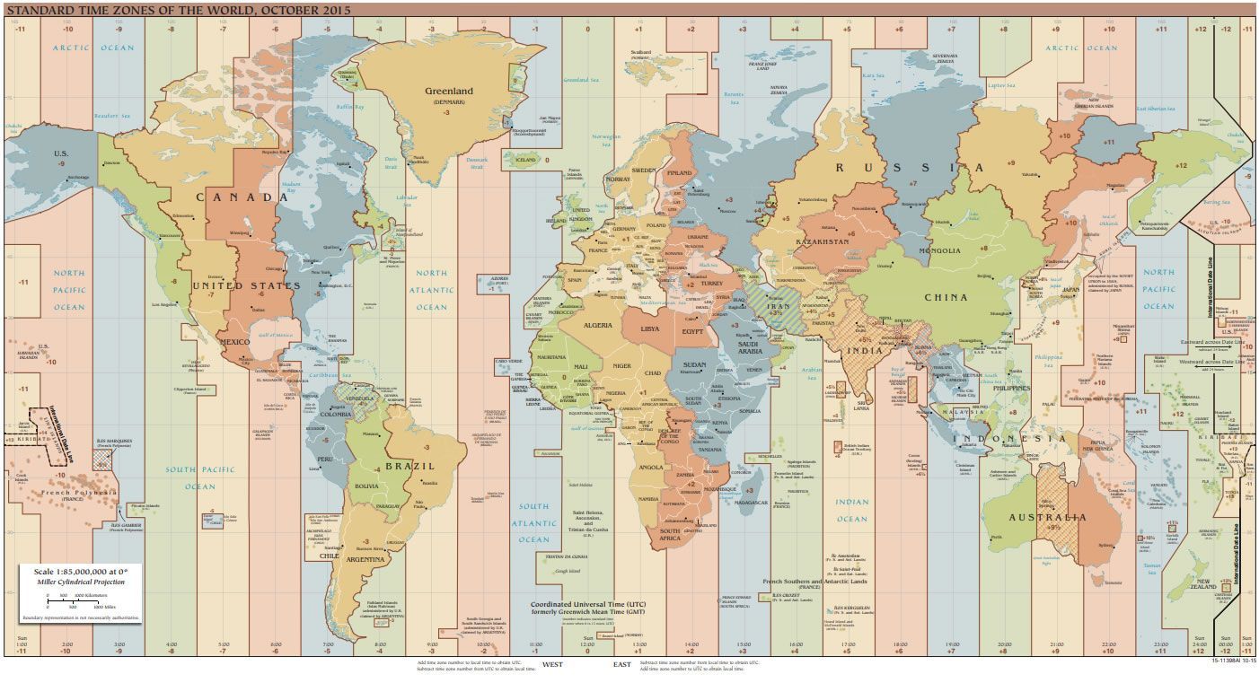
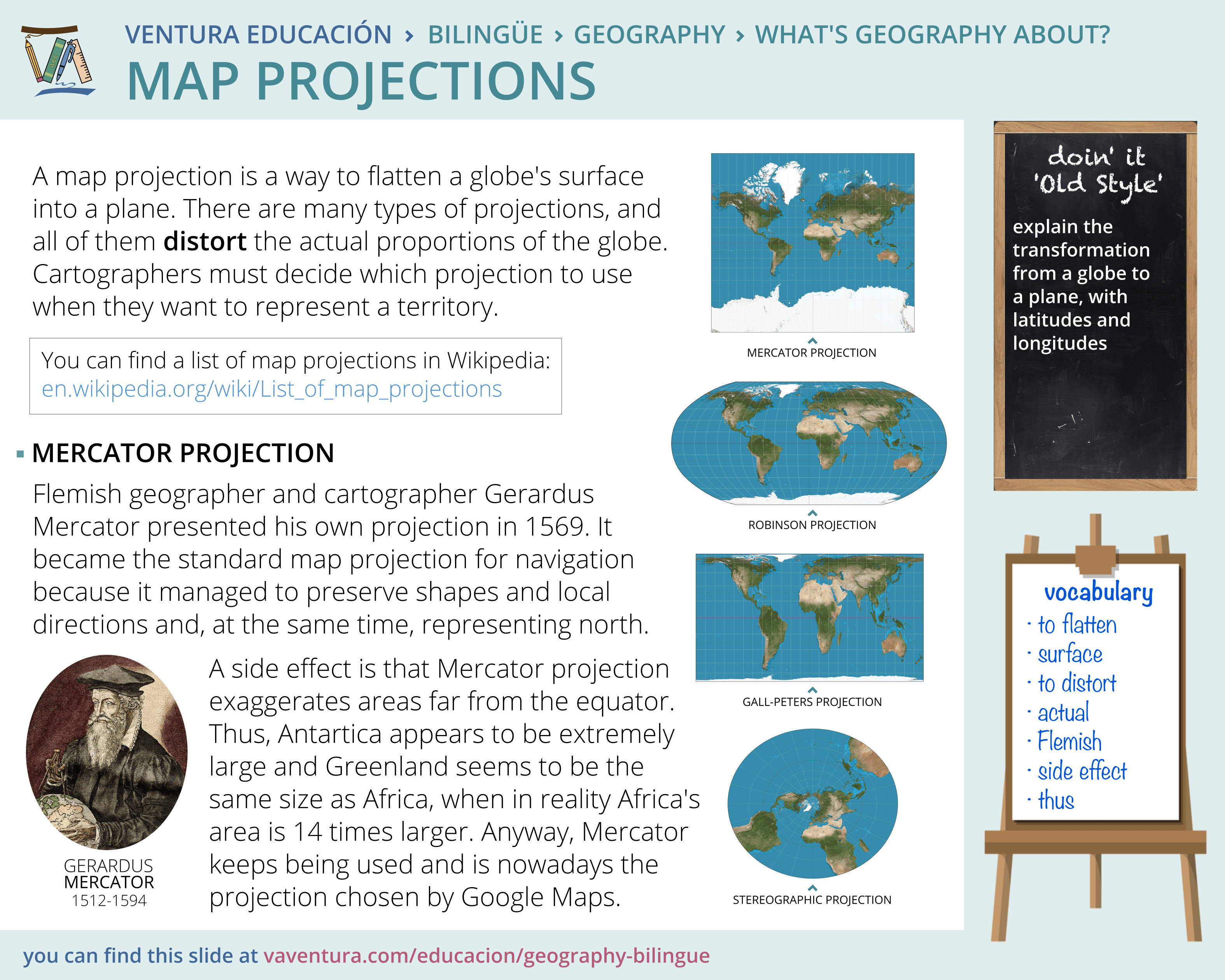
A map is a tool with a purpose: representing the World in a certain way. There are many ways a map can represent the actual size of the World, and they are all true and faithful to reality. These ways of representing the Earth in a flat plane are called projections.
Evolution of mapping
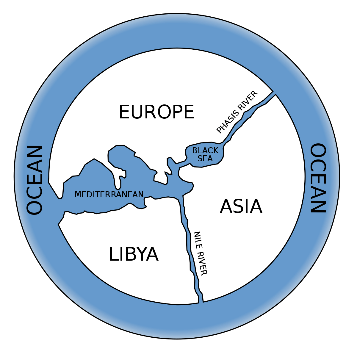
We humans have always wanted to know the world around us. Although today maps are full of information and very accurate, they can be just a simple drawing on a stone or parchment. That’s what Anaximander did with his famous -and very simple- map of the World. It featured Europe, Asia and Africa (called Libya), with five masses of water: Mediterranean Sea, Black Sea, Nile River, Phasis River and a Great Ocean surrounding the continents. For sure it was simple, but effective to explain the world they knew.
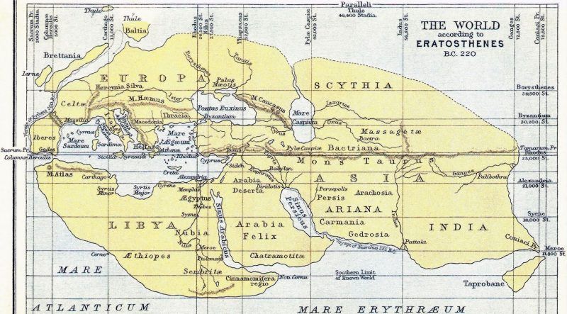
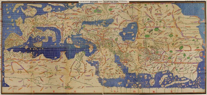
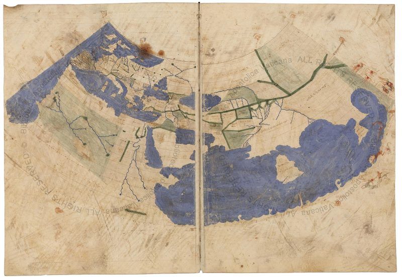
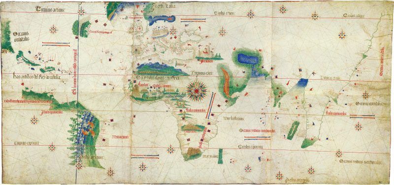
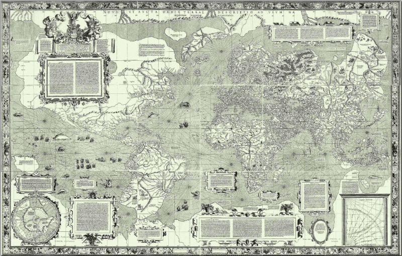
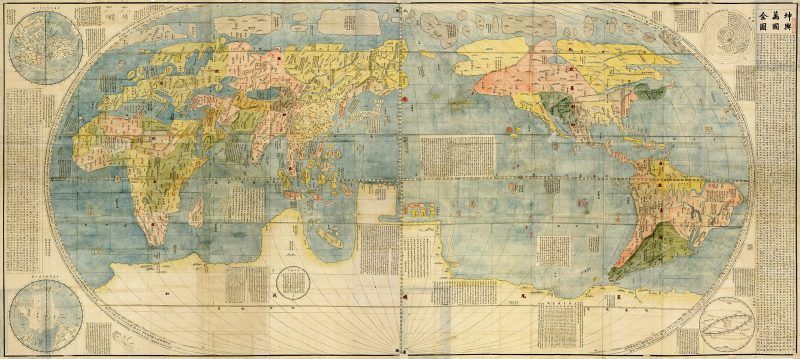
Four hundred years later, Eratosthenes represented Alexander the Great’s conquests through Asia in a much more accurate map. For a thousand years there were no major improvements in cartography. The world only got bigger in western maps once Columbus set sail in America. Thanks to the advances in navigation and measurement techniques, cartographers -along with explorers- travelled the world and made great maps, like Matteo Ricci’s famous Kunyu Wanguo Quantu, the first Chinese world map made with a European style.